Did you ever have to give a grammar school report on the painful details of “How I spent my summer vacation” ? Admit it. You did. And it made you squirm. Worse, it made your classmates wonder if they’d ever again let you play with them at recess.
And after you grew to adulthood, you certainly remember insisting that your friends endure a photo album or slide show of all the great Kodak Moments you captured on your oh-so-grown-up summer vacation. Right?
(Didn’t learn anything in grammar school, did you?)
Well, at the risk of jeopardizing my playground future and losing whatever adults who may yet count me among their friends… I’m gonna tell you how I spent my summer vacation. With a string of photos, no less.
I’m resorting to this story-telling approach, because today’s BCingYou trek was mostly road trip and snapshots. I made a leisurely departure from Heriot Bay after spending the morning at the marina with a good book. I drove; I hiked; I poked around. And I spoke to almost nobody, apart from the solo Brit who’d settled into the same Sayward, B.C. tenter's campground as me. Our 2 silver Volvos were the conversation starter. (His being a hire car.) But true to his national character, the conversation died quickly.
We could have talked about the remarkable history of Sayward. As late as 1979 this was the end of the road for Vancouver Island. Literally. The only way to reach the communities further north was by boat or by air. In 1966 the BC Ferries' "Queen of Prince Rupert" was put into service as the only scheduled connection between Vancouver Island and Prince Rupert on the northwest coast of mainland B.C. But in 1979, the Island Highway finally pushed north to Port Hardy. The "Queen of Prince Rupert" made her last Sayward run that same year. The local logging industry fell upon hard times. And Sayward virtually disappeared from the map. Even the local H'Kusam First Nations people left. Today a conveniently located campground and a spectacular footpath around the Salmon River Estuary are all that attract visitors.
That said... you're now left with nothing more interesting than my TOP 20 travel photos du jour. I ask you to click onto the Photo Gallery link to the RIGHT. And read below for the annotations, which match the NUMBERED captions in the Photo Gallery. (Or quit now and wait for my next Post. Unlike grammar school, you can cut this class.)
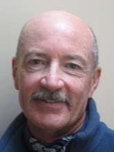
ONE – Brian and Rob sailing away from Heriot Bay. (See 9th Post for introductions.)
TWO – Famous Kwawaka'wakw master carver Sam Henderson made these totems just before he died. Totems are typically raised at important community sites, as here, at a native people's cemetery.
THREE – The place along the Campbell River where Tyee Club rules prevail (see 4th Post.)
FOUR – Tyee guides and rowboats, circa 1930. This is my snapshot of a photo hanging in the historic Tyee Club Room at Painter's Lodge. The original historic Lodge burnt down and today's lodge is an uninspired, upscale destination spot for boaters, holiday makers and business retreats. But the history and the on site artifacts are charming. Lots of fisher-photos of royalty and Hollywood celebrities from the 30s, 40s and 50s.
FIVE – A splendid seaplane.
SIX – Sayward's Visitors' Center. Looks like a set piece in 'Northern Exposure.' But it's for real.
SEVEN – Sayward's one-lane wooden bridge over the Salmon River.
EIGHT – Iconic 240 Volvo striking a Nordic pose in Sayward.
NINE – Sayward's Salmon River Estuary
TEN – Sayward's Salmon River Estuary
ELEVEN - Sayward's Salmon River Estuary; I watched from this spot as a duck (?) captured and swallowed a broad, flat fish that I would have thought impossible to get down its throat.
TWELVE - Sayward's Salmon River Estuary
THIRTEEN - My Sayward campsite, with a moonless night filled with stars, I opted to leave the rainfly off the tent for night sky viewing.
FOURTEEN - My recipe for campsite dessert.
FIFTEEN - You can't belive how delicious this dessert tasted at the end of the day.
SIXTEEN - 65 kilometers of Elks
SEVENTEEN - Hundreds of kilometers of logging roads; the signs showed more bullet holes the further north I drove.
EIGHTEEN - A Canada rock with 'Canada Rocks.'
NINETEEN - Morning highway scene.
TWENTY - Afternoon highway scene. The northern island is very wild and undeveloped.
O.K. You’ve endured bravely. I promise I’ll return to more narrative Postings after I reach Port Hardy to begin my long ferry trek to Bella Coola.